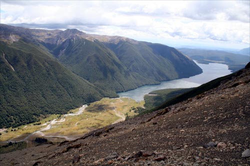
The landscape of much of Nelson Lakes National Park, which lies on the eastern side of the Alpine Fault, resembles Canterbury’s mountains, due to recent glaciations and the underlying geology of greywacke which weathers to form distinctive scree slopes. Lake Rotoiti is the smaller of the two large glacial lakes in the national park. These formed when rivers were dammed behind past glaciers’ terminal moraines (ridges of rubble that form at the front of a glacier).
Using this item
Private collection
Photograph by Jock Phillips
This item has been provided for private study purposes (such as school projects, family and local history research) and any published reproduction (print or electronic) may infringe copyright law. It is the responsibility of the user of any material to obtain clearance from the copyright holder.


Add new comment