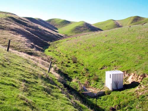
A first step in drawing up soil conservation guidelines was to measure water run-off and sediment content in different management systems. Today there is also emphasis on measuring the phosphorus and nitrogen content of the runoff water. This is a site for measuring run-off flow from a farmed catchment. The height of the water flowing through the V notch weir is automatically recorded by equipment in the small hut. Samples are also periodically taken for measurement of water quality. Measurements of surface run-off can also be made using small run-off plots.
Using this item
Private collection
by Allan Gillingham
This item has been provided for private study purposes (such as school projects, family and local history research) and any published reproduction (print or electronic) may infringe copyright law. It is the responsibility of the user of any material to obtain clearance from the copyright holder.
Comments
05 November 2016