Image
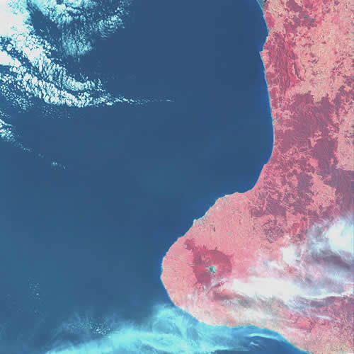
The data for this satellite image of Taranaki was recorded by Landsat 1 as it passed over New Zealand on 30 January 1974. The data consisted of wavelengths from four spectral bands – one green, one red, and two infrared. The native bush of Egmont National Park shows up clearly against the lighter pink of the cleared land in Taranaki.
Using this item
Landcare Research – Manaaki Whenua
© Copyright image. All rights reserved. Permission from Manaaki Whenua: Landcare Research New Zealand Limited must be obtained before the re-use of this image.
Comments
28 February 2013