Image
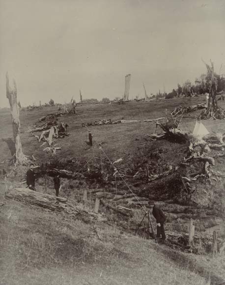
These surveyors are measuring part of the Eltham-Okaiawa baseline in Taranaki in 1910–1911. Measuring a baseline was often complicated by rough terrain. Here, the supports for the steel tape have been extended up to 15 feet (4.6 metres) in order to get a flat line across the gully. Once the bearing and measurement were recorded, the tape and supports would be taken down and moved to measure the next bay – a slow and laborious process.
Using this item
Reference: 1/2-019458; C
Permission of the Alexander Turnbull Library, National Library of New Zealand, Te Puna Mātauranga o Aotearoa, must be obtained before any re-use of this image.