Image
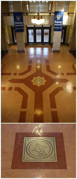
This plaque, on the floor of the foyer at Massey University in Wellington (in a building that was formerly the National Museum), marks the position of the former Mt Cook trig station, which was once the zero point of the New Zealand land survey system.
Using this item
Te Ara - The Encyclopedia of New Zealand
by Melanie Lovell-Smith
This item has been provided for private study purposes (such as school projects, family and local history research) and any published reproduction (print or electronic) may infringe copyright law. It is the responsibility of the user of any material to obtain clearance from the copyright holder.