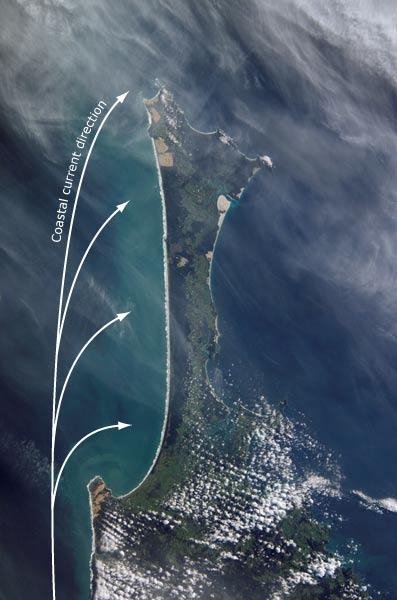
Ocean currents move sand northwards along the Aupōuri Peninsula coast, seen here in a satellite photograph. Strong prevailing westerly winds then blow it off beaches. It drifts inland, forming dunes (the light-coloured patches). Many of the peninsula’s former dune lands have been planted in pine forests – visible as the dark green areas.
Using this item
Reference: International Space Station Crew Earth Observations Experiment and the Image Science & Analysis Group, ISS004-E-13337
This item has been provided for private study purposes (such as school projects, family and local history research) and any published reproduction (print or electronic) may infringe copyright law. It is the responsibility of the user of any material to obtain clearance from the copyright holder.