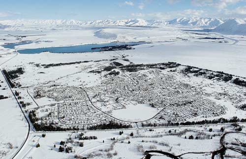
Twizel was created by the state as a construction town for the Upper Waitaki hydroelectric scheme. At Ōtemātātā 550 houses were built in government workshops and then trucked to Twizel. Around 24 kilometres of streets were laid in a curvilinear pattern and joined by an internal ring road – Mackenzie Drive. Shops and facilities were centrally located. Pedestrians could safely walk to the town centre through green reserves. The original plan to dismantle the town (once the scheme was built) was reversed because of public opposition.
Using this item
Reference: 15 June 2006
by Gerard O'Brien
Permission of the Otago Daily Times must be obtained before any re-use of this image.