Image
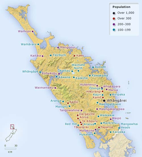
This map showing towns of more than 100 people illustrates the very dispersed nature of settlement in Northland in 1906. The sawmilling and kauri-gum industries were then at their height, and towns sprang up around them. Because there were few roads or railways, settlements were located near navigable waters – on rivers, coasts or harbours.
Using this item
Te Ara – The Encyclopedia of New Zealand
Source: New Zealand official yearbook, 1906
This item has been provided for private study purposes (such as school projects, family and local history research) and any published reproduction (print or electronic) may infringe copyright law. It is the responsibility of the user of any material to obtain clearance from the copyright holder.