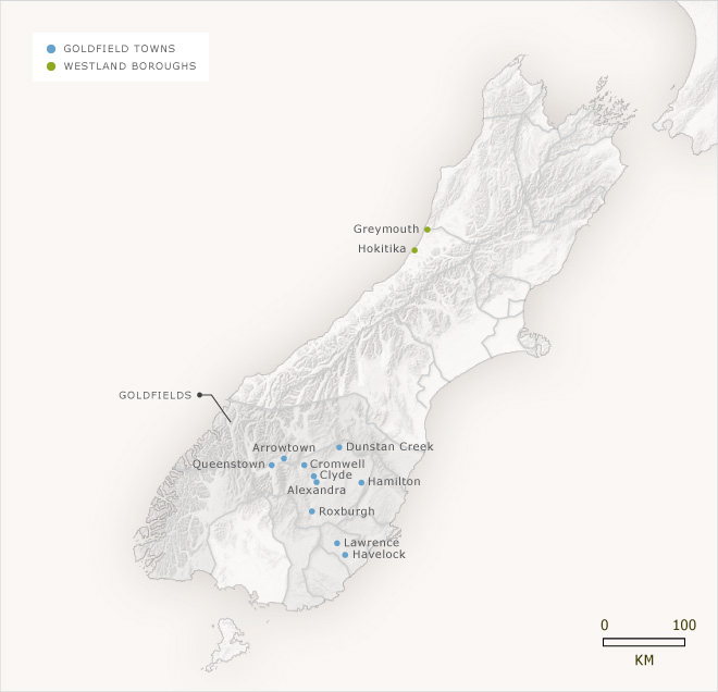
The goldfield electorates shown on this map allowed the relatively huge population of transient miners to vote by presenting their miner's licence. The goldfield electorates overlaid existing general electorates. The result was that neighbours, one a licensed miner, the other a local property owner, would vote in different electorates. The Goldfields electorate, which overlaid Otago province, was even stranger. It included all the small towns that had sprung up around gold-mining communities. Each section was politically linked but geographically separate from the others.
Using this item
Te Ara - The Encyclopedia of New Zealand
Source: Alan McRobie, New Zealand electoral atlas. Wellington: GP Books, 1989
This item has been provided for private study purposes (such as school projects, family and local history research) and any published reproduction (print or electronic) may infringe copyright law. It is the responsibility of the user of any material to obtain clearance from the copyright holder.