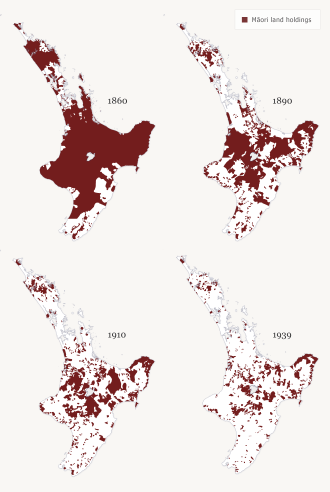
This series of maps shows the transfer of North Island land ownership, from Māori ownership to general and Crown land, between 1860 and 1939. The brown areas represent Māori land (held in tribal ownership). Many of these transfers of ownership were transacted through the Native Land Court (renamed the Māori Land Court in 1947).
Using this item
Te Ara - The Encyclopedia of New Zealand
Source: Claudia Orange, Illustrated history of the Treaty of Waitangi. Wellington: Bridget Williams Books, 2001, pp. 318–319
This item has been provided for private study purposes (such as school projects, family and local history research) and any published reproduction (print or electronic) may infringe copyright law. It is the responsibility of the user of any material to obtain clearance from the copyright holder.