Image
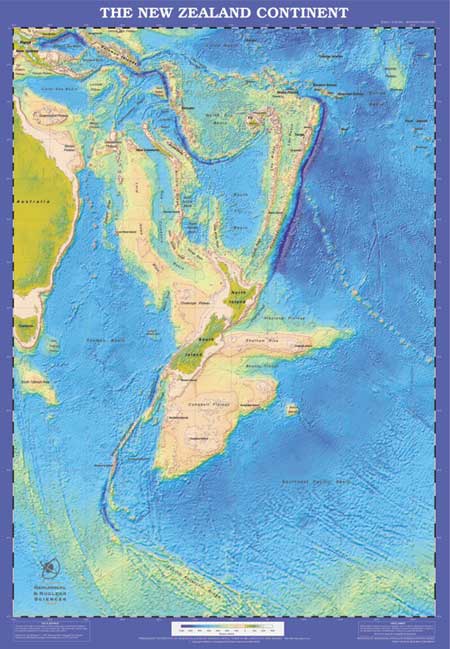
New Zealand once covered a much greater land area than it does today. The New Zealand continental plateau, which covers some 3 million sq km (roughly 10 times the visible land area), is mostly underwater. Around 20,000 years ago, when New Zealand was heavily glaciated, sea levels were lower and much more of the continental shelf (coloured tan in this map) was visible in the form of huge plains.