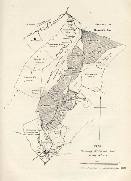
The Crown purchased large tracts of traditional Rangitāne land on both sides of the Tararua Range for Pākehā settlement in the 1860s and 1870s. The shaded area on this 1874 map shows the land that was identified as suitable for settlement between Masterton and Woodville.
Using this item
Te Ara - The Encyclopedia of New Zealand
Reference: Appendix to the Journals of the House of Representatives (New Zealand), 1874, D–5a.
This item has been provided for private study purposes (such as school projects, family and local history research) and any published reproduction (print or electronic) may infringe copyright law. It is the responsibility of the user of any material to obtain clearance from the copyright holder.