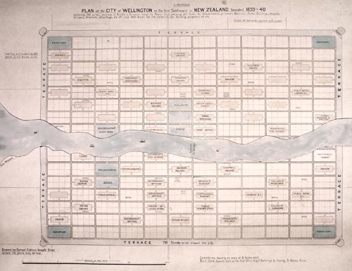
Before 1840 European settlement of New Zealand was sporadic. In that year, the first settlers despatched by the New Zealand Company arrived at Wellington. Over the next decade, the company or its offshoots also founded Whanganui, Nelson, New Plymouth, Dunedin and Christchurch. This map showing the proposed layout of the town of Wellington, with its 1,100 one-acre (0.4-hectare) town sections, was drawn in England to convince investors to support the venture. In reality, the company’s surveyor, William Mein Smith, struggled to follow this elaborate plan when he first laid the settlement out at Petone.
Using this item
Archives New Zealand - Te Rua Mahara o te Kāwanatanga
Reference: LS2044
Permission of Archives New Zealand Te Rua Mahara o te Kāwanatanga must be obtained before any re-use of this material.
Comments
02 May 2017
11 March 2017