Image
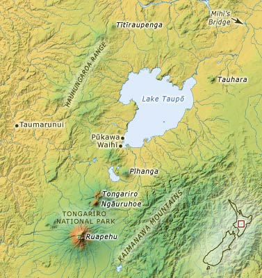
Ngāti Tūwharetoa’s tribal area surrounds Lake Taupō and is bounded by Mihi’s Bridge in the north, the Hauhungaroa Ranges in the west, the Kaimanawa Mountains in the east and Tongariro National Park in the south.
Using this item
Te Ara - The Encyclopedia of New Zealand
This item has been provided for private study purposes (such as school projects, family and local history research) and any published reproduction (print or electronic) may infringe copyright law. It is the responsibility of the user of any material to obtain clearance from the copyright holder.