Image
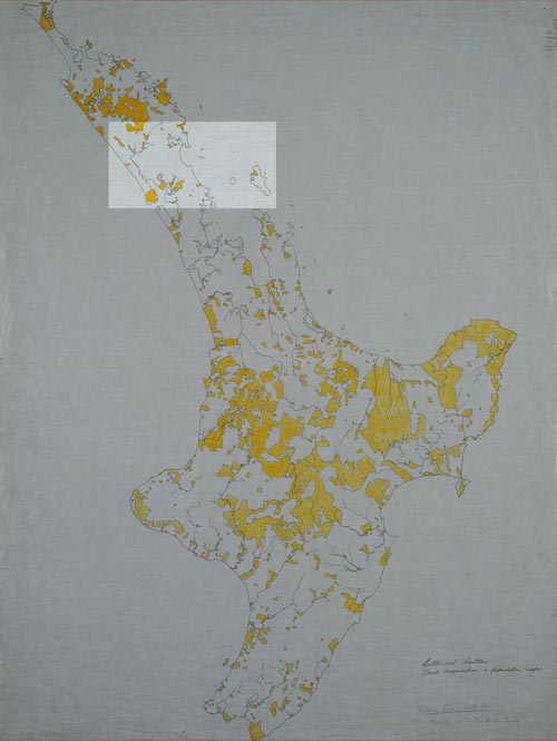
The Whangārei tribes suffered greatly from the loss of their lands. By 1936 less than 4 hectares per head remained in Māori hands in the whole Auckland area. This map, prepared for the unpublished centennial historical atlas in the 1940s, shows in yellow the Māori-owned land in 1910; in the Whangārei area, the holdings were minuscule.
Using this item
Alexander Turnbull Library, Centennial Historical Atlas Collection
Reference: MapColl-CHA-6/2/6-Acc.38315
Permission of the Alexander Turnbull Library, National Library of New Zealand, Te Puna Mātauranga o Aotearoa, must be obtained before any re-use of this image.