-
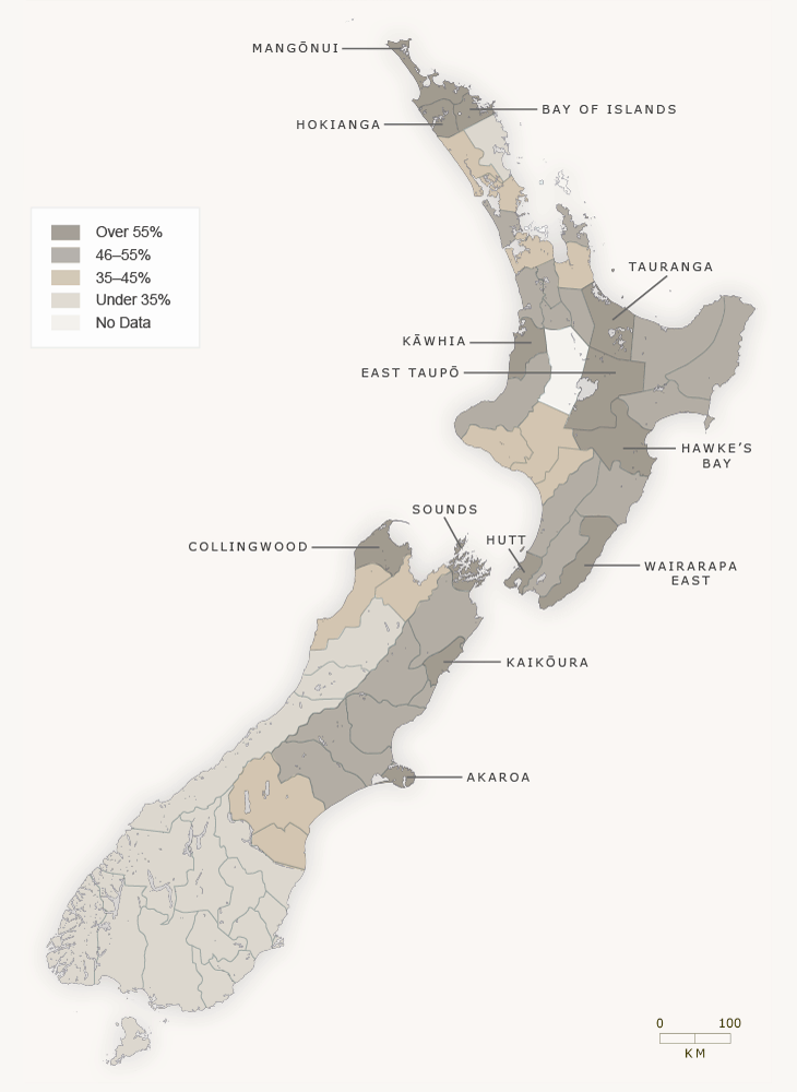
Anglican
-
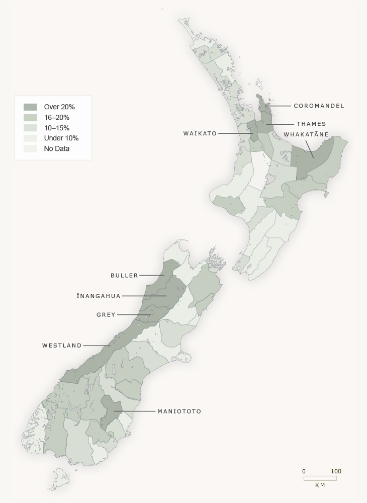
Catholic
-
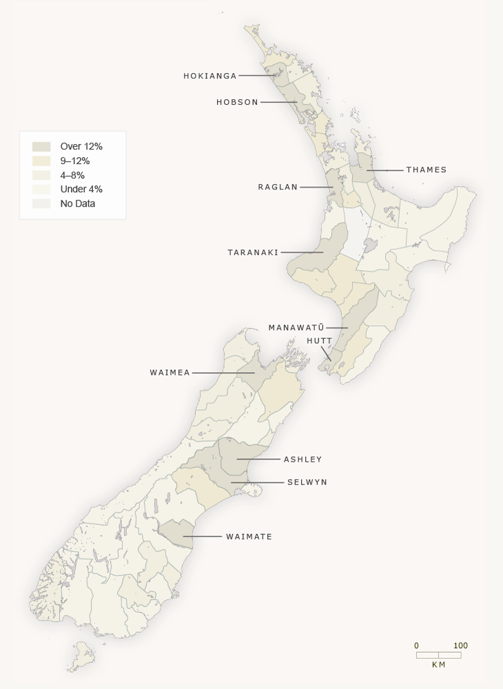
Methodist
-
Presbyterian
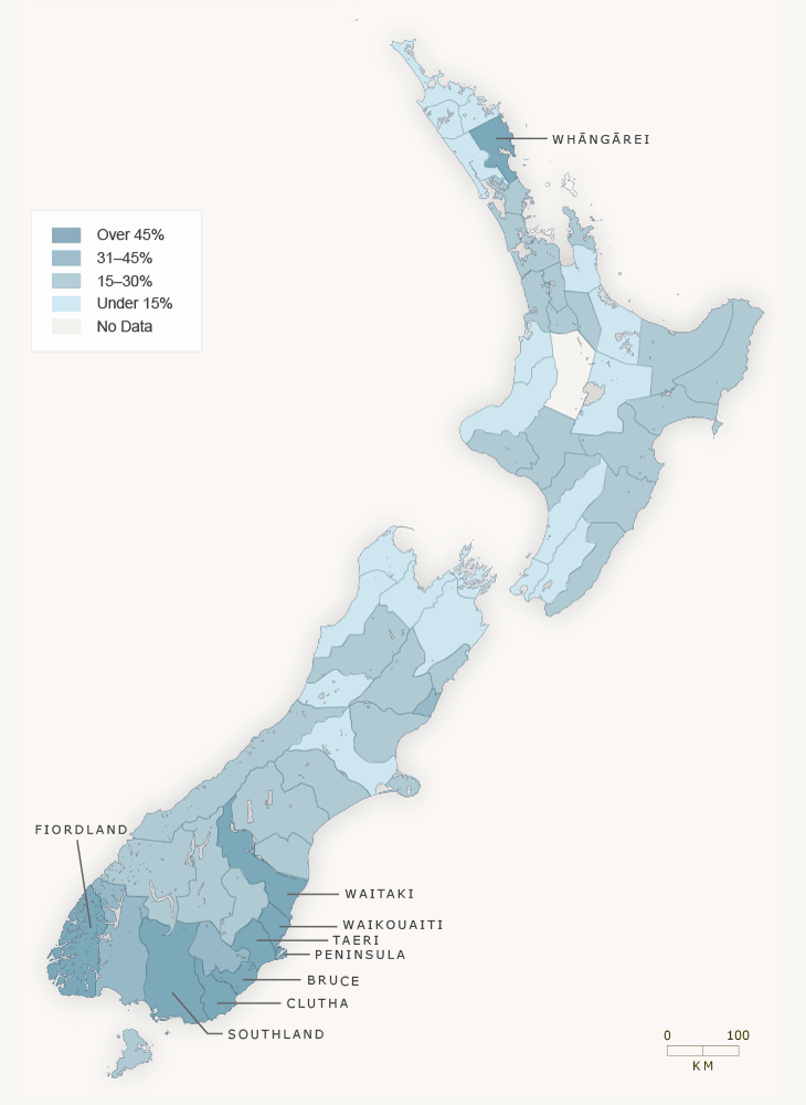
This map shows the geographical distribution of adherents of the four major Christian denominations in New Zealand, as recorded in the census of 1878. The map does not include boroughs – it only represents the rural population. However, it shows clearly that Anglicans were over 40% of the population in most of the North Island. In the South Island Anglicans were well represented in Canterbury and Nelson, Catholics were found in relatively large numbers on the West Coast, and Presbyterians were numerous in Otago and Southland. The good representation of Methodists in Taranaki was a consequence of the many Cornish settlers in that part of New Zealand.
Using this item
Te Ara - The Encyclopedia of New Zealand
This item has been provided for private study purposes (such as school projects, family and local history research) and any published reproduction (print or electronic) may infringe copyright law. It is the responsibility of the user of any material to obtain clearance from the copyright holder.