-
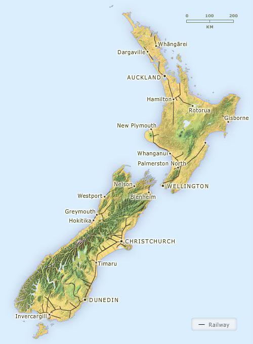
1905
-
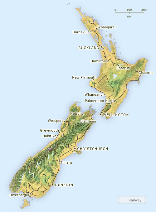
1950s
-
2008
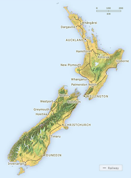
By 1905 the national railway network was quite extensive, with lines linking many farming regions with their local port. The network reached its greatest extent in the 1950s, and most rural areas were connected with the main centres. However by 2008 the railways had shrunk considerably. Many branch lines had closed, as road freighting became a more cost-effective way of transporting farm produce and supplies.
Using this item
Te Ara - The Encyclopedia of New Zealand
This item has been provided for private study purposes (such as school projects, family and local history research) and any published reproduction (print or electronic) may infringe copyright law. It is the responsibility of the user of any material to obtain clearance from the copyright holder.
Comments
11 April 2012