-
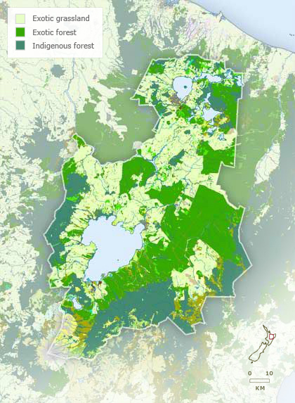
Vegetation
-
Landforms

-
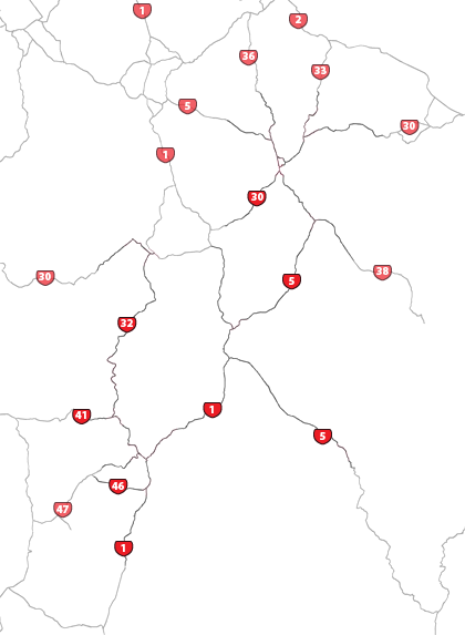
Highways
-
Districts
-
Place names
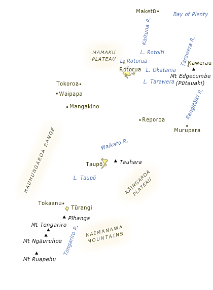
The Volcanic Plateau stretches from the Bay of Plenty coast to south of Ruapehu. The region’s landforms have been formed by volcanic activity, which has produced volcanoes, massive calderas occupied by lakes, hot springs, mud pools and steaming mountainsides. To the east the Plateau is bounded by the greywacke ranges of the main divide; to the west it is edged by the western uplands, mostly formed of sedimentary rocks.
Using this item
Te Ara - The Encyclopedia of New Zealand
This item has been provided for private study purposes (such as school projects, family and local history research) and any published reproduction (print or electronic) may infringe copyright law. It is the responsibility of the user of any material to obtain clearance from the copyright holder.