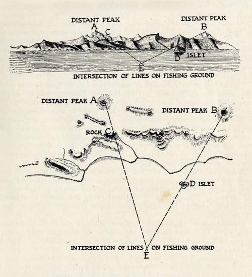
This diagram shows how two distant mountain tops were used by fishermen to locate a fishing ground. The desired spot (E) lies at the intersection of two lines: one runs from peak A through a rock (C) on one side, and the other runs from peak B through an islet (D) on the other side.
Using this item
Te Ara - The Encyclopedia of New Zealand
Reference: Elsdon Best, Fishing methods and devices of the Maori. Wellington: Dominion Museum, 1929, p. 112
This item has been provided for private study purposes (such as school projects, family and local history research) and any published reproduction (print or electronic) may infringe copyright law. It is the responsibility of the user of any material to obtain clearance from the copyright holder.