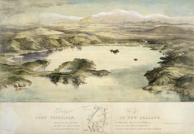
Ports were essential to settlements, and their promoters liked to talk up the advantages of their anchorages. Wellington Harbour, an excellent deep-water harbour, featured prominently in New Zealand Company propaganda. This view, drawn by Charles Heaphy in 1839, and lithographed by T. Allom and published in 1843, is technically accomplished and at first sight appears remarkably accurate. But the amount of flat land has been exaggerated, the hills have been softened and shortened, and the Hutt River (centre right) has been made to look improbably fit for navigation.
Using this item
Reference: C-029-006-b
by Charles Heaphy
Permission of the Alexander Turnbull Library, National Library of New Zealand, Te Puna Mātauranga o Aotearoa, must be obtained before any re-use of this image.