

The Wellington–Mōhaka Fault
The North Island’s longest active fault runs from Cook Strait to the Bay of Plenty. The southern section is the Wellington Fault; the northern section is called the Mōhaka Fault. The Wellington section presents a major hazard, as it goes through the heart of New Zealand’s capital city and is crossed by numerous bridges, roads and pipelines. About three-quarters of the people in the Wellington region live within 10 kilometres of the fault.
Wellington owes its distinctive landscape to this fault. Near the coast, the sea has flooded into the fault depression to create Wellington Harbour. During earthquakes along the fault, land along the north-western side of Wellington Harbour and the Hutt Valley moves upward, while in areas south-east of the fault land subsides.
Further inland, the Hutt River flows down the depression and has filled the Lower and Upper Hutt areas with hundreds of metres of sediment.
Movement along the 75-kilometre-long segment of the Wellington Fault from Cook Strait through Wellington and the Hutt Valley to Kaitoke is considered likely to cause a major earthquake in the future. At least two earthquakes have occurred on this part of the Wellington Fault in the last 1,000 years, with the most recent less than 310 years ago. During the last four earthquakes, sections of land on opposite sides of the fault moved past each other by about 5 metres. Such movement would produce earthquakes of the order of magnitude 7.5.
Large earthquakes on this section of the fault are estimated to occur about every 500 to 1,000 years.
The Alpine Fault
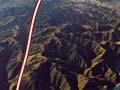
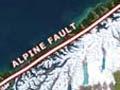
The western ramparts of New Zealand’s Southern Alps define a remarkable straight line visible from space – the trace of the Alpine Fault. It is the longest active fault in New Zealand. Onshore it extends 650 kilometres from Blenheim to Milford Sound.
The Alpine Fault is a major plate boundary, where the moving Pacific and Australian plates collide and scrape past each other. In 1948, geologist Harold Wellman realised that rocks that were once adjacent to each other had been separated by 480 kilometres as a result of movement along the Alpine Fault.
No major earthquakes have occurred on the Alpine Fault since Europeans settled in New Zealand. Its most recent movements, determined by tree-ring dating and radiocarbon dating of plant material in trenches dug across the fault, indicate earthquakes around 1460 CE, and around 1630 between the Paringa and Ahaura rivers (about 250 kilometres). The most recent earthquake was about 1717, when over 300 kilometres of the fault ruptured, from Milford to the Haupiri River.
On these occasions, there was over 7 metres of horizontal movement and one metre of uplift along the fault, producing earthquakes with magnitudes of about 8. The quakes have not all been on the same section of the fault.
Because of recent research at sites where sediment and vegetation have accumulated due to fault movement, however, the Alpine fault now has one of the longest continuous earthquake records of any plate boundary fault in the world. There is now evidence of 27 surface ruptures of the fault, dating back to 6,000 BCE. The average interval between large earthquakes on the central section of the fault is about 250 years. The longest interval was about 350 years and the shortest about 160 years.
Rise and fall
New Zealand’s Southern Alps are one of the fastest-rising mountain ranges in the world, and over the last 5 million years they have been moving up at an average rate of about a centimetre per year. This uplift is not continuous – much of it occurs in jumps of several metres at a time during earthquakes along the Alpine Fault. Scientists estimate that the land east of the Alpine Fault has risen by as much as 20 kilometres. The mountains, however, have never been much higher than they are at present – a little over 3 kilometres – because erosion wears them down about as fast as they go up.
Marlborough Fault system
The north-eastern region of the South Island is traversed by a series of major active faults, including the Wairau, Awatere, Clarence and Hope faults. Along these faults sideways and upward movement have created mountains such as the Richmond, and Inland and Seaward Kaikoura ranges, and major river valleys such as the Wairau and Awatere. On 14 November 2016, a series of over 20 separate short faults ruptured in succession north-eastward along 180 kilometres of the Marlborough coast, producing the magnitude 7.8 Kaikoura earthquake.