Image
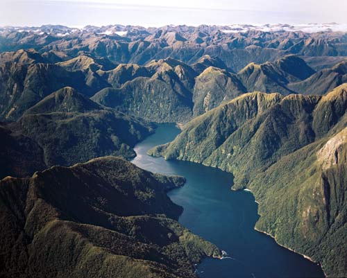
Dagg Sound is one of many fiords along the western coastline of Fiordland. They are troughs excavated by ice-age glaciers, which were flooded by the sea when the ice melted. The peaks around Dagg Sound are only 1,100–1,200 metres above sea level, but the steep slopes of the fiord make them seem higher. Some fiords extend far into the mountainous hinterland of Fiordland National Park.
Using this item
Reference: CN6245/2
by Lloyd Homer
Permission of GNS Science must be obtained before any use of this image.