
Story: Soil investigation

Drafting a soil map

Image
Drafting a soil map

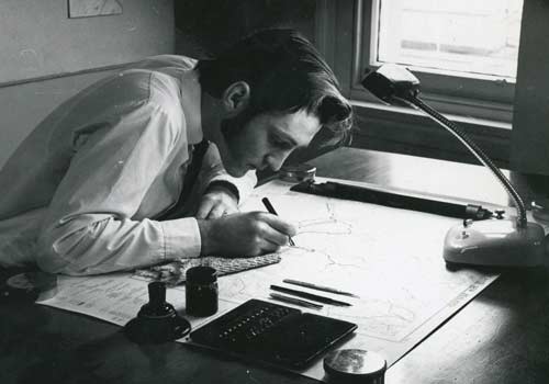
By the 1950s some aspects of soil surveying had changed little since the beginning of the century. Here, Bill Rennie painstakingly drafts a map.

Using this item

Landcare Research – Manaaki Whenua

© Copyright image. All rights reserved. Permission from Manaaki Whenua: Landcare Research New Zealand Limited must be obtained before the re-use of this image.

All images & media in this story

How to cite this page

P. J. Tonkin, Soil investigation – DSIR soil science: 1930–1950, Te Ara – the Encyclopedia of New Zealand, https://teara.govt.nz/en/photograph/14190/drafting-a-soil-map (accessed 4 June 2026).

Story by P. J. Tonkin, published 1 March 2009.