Image
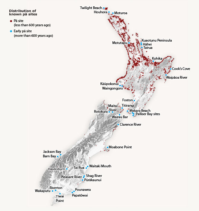
This map shows the distribution of pā throughout New Zealand. The concentration of pā was strongest in the coastal parts of the North Island, from Whanganui and Hawke's Bay northwards. Their location coincides with the best areas to plant and grow Polynesian crops such as kūmara and taro. Fortified pā reflected the prevalence of warfare, which would have replaced the leisure time of the summer months.
Using this item
Te Ara - The Encyclopedia of New Zealand
Source: Malcolm McKinnon, ed., Bateman New Zealand historical atlas: ko papatuanuku e takoto nei. Auckland: David Bateman, 1997, plate 11
This item has been provided for private study purposes (such as school projects, family and local history research) and any published reproduction (print or electronic) may infringe copyright law. It is the responsibility of the user of any material to obtain clearance from the copyright holder.