Image
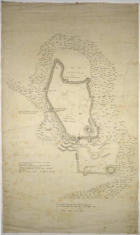
At the time of Ngāti Toa’s attacks on Ngāi Tahu, Kaiapoi pā was the greatest of Ngāi Tahu’s settlements. As this plan shows, it was surrounded on three sides by swamp and modified at its landward approach because Ngāti Toa were well armed with muskets. In 1831–32, after a long siege, Te Rauparaha managed to take the pā when the palisades caught fire.
Using this item
Reference: MapColl-834.44941hkcmf/1870/Acc5100
by Alex Macdonald
Permission of the Alexander Turnbull Library, National Library of New Zealand, Te Puna Mātauranga o Aotearoa, must be obtained before any re-use of this image.