
Story: Local and regional government

South Island district and city council boundaries

Image
South Island district and city council boundaries

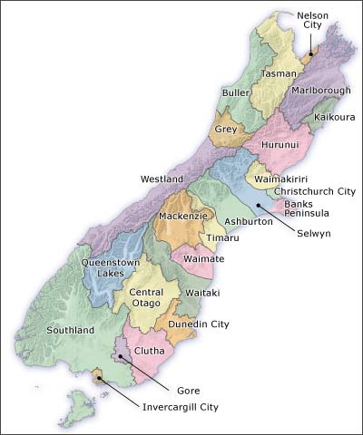
The district and city council boundaries for the South Island are shown on this map.

Using this item

Te Ara - The Encyclopedia of New Zealand

This item has been provided for private study purposes (such as school projects, family and local history research) and any published reproduction (print or electronic) may infringe copyright law. It is the responsibility of the user of any material to obtain clearance from the copyright holder.

All images & media in this story

How to cite this page

Mark Derby, Local and regional government – Local authorities after 2000, Te Ara – the Encyclopedia of New Zealand, https://teara.govt.nz/en/map/2739/south-island-district-and-city-council-boundaries (accessed 4 June 2026).

Story by Mark Derby, published 3 March 2009, updated 1 February 2015.

Comments

Hamish Rennie
28 February 2017
Your map of the South Island district councils is inaccurate. Banks Penninsula combined with Christchurch over a decade ago.