
Story: Historic volcanic activity

Ruapehu Crater Lake after the 1953 lahar

Image
Ruapehu Crater Lake after the 1953 lahar

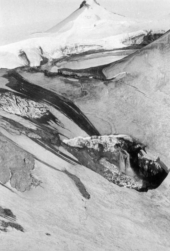
A few days after the volcanic debris around Crater Lake collapsed, releasing a torrent of water and rubble, the level of the lake dropped, exposing a mudflat on the far side. The chasm in the foreground has been gouged out, washing away all the snow and exposing bare rock.

Using this item

GNS Science

Reference: SL127/1

Permission of GNS Science must be obtained before any use of this image.

All images & media in this story

How to cite this page

Eileen McSaveney, Carol Stewart and Graham Leonard, Historic volcanic activity – Ruapehu and the Tangiwai disaster, Te Ara – the Encyclopedia of New Zealand, https://teara.govt.nz/en/photograph/6875/ruapehu-crater-lake-after-the-1953-lahar (accessed 4 June 2026).

Story by Eileen McSaveney, Carol Stewart and Graham Leonard, published 2 March 2009.