

Tūrangi
Town at the southern end of Lake Taupō, 51 km south of Taupō town, with a 2013 population of 2,955. Tūrangi had its origins in huts and lodges built for visitors fishing the Tongariro River, and it still calls itself the ‘trout fishing capital of the world’.
New town
From the mid-1960s, the fishing settlement was overshadowed by the building of a town to house workers on the Tongariro power scheme. The project diverted water from the Whangaehu, Moawhango, Tongariro and Whanganui river catchments to power stations at Rangipō and Tokaanu.
The new town was laid out west of the re-aligned State Highway 1, while the older community remained to the east. Typical of planned towns of the time, the new town had curved streets, bungalows and a pedestrian shopping mall. The recruitment of Italian tunnellers to the scheme led to an unusual feature for a small town of the time – an Italian restaurant. Today farm servicing and tourism provide jobs.
Population
Tūrangi’s population reached 4,000 by early 1967, and peaked at 5,517 in 1981, when the work was completed. The 2013 population was almost 800 fewer than that in 1996. In 2013 more people in Tūrangi identified themselves as Māori than as European.
Māori
Waitahanui pā was located at the mouth of the Tongariro River. When muskets became common in 1820s inter-tribal warfare, the pā was abandoned for more secure positions on a hill at Whakatara and on Motutaiko Island. Today, the Hīrangi marae is in Tūrangi and the Kōrohe marae is a few kilometres north on State Highway 1.
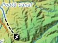
The Te Ponanga saddle road, built partly to service the power scheme, provides a direct and scenic route to the western Ruapehu skifields.
Tongariro tales
Some of the fishing pools in the Tongariro River have names that tell a story – such as Duchess, after the Duchess of York (later Queen Elizabeth, consort of George VI). Other names include Breakfast, Judges, Sportsman’s, Bridge and Lonely.
Tongariro River
New Zealand’s premier trout-fishing river, its waters rise on the slopes of the central volcanoes and the Kaimanawa Mountains. Trout were first fished there in the 1900s. By the 1920s anglers came from around the world, including the American writer Zane Grey and the Duchess of York (later the Queen Mother). Then as now, fishers frequented a series of river pools near Tūrangi. The Tongariro National Trout Centre is on the river bank, 4 kilometres south of the town.
Rangipō and the Desert Road
Locality and district 11 km south of Tūrangi. The name Rangipō means night sky, and is associated with the travels of Te Arawa ancestor Ngātoroirangi.
A prison camp was built in the area in 1922 at Hautū, and conscientious objectors were detained there during the Second World War. Today the Tongariro and Rangipō prisons manage farms on much of the land east of Rangipō and Tūrangi.
The 46-kilometre Desert Road, part of State Highway 1, reaches 1,074 metres at its summit (the highest main road in the North Island) and is often closed by winter snow. The Tūkino skifield, Ruapehu’s smallest, operated by a ski club, is reached by a side road at the summit.
The ‘desert’ has shrub and tussock and no trees. The road was completed in the 1930s, and crosses land that has been heavily dissected by streams cutting into lahars (mud flows) from the central volcanoes. Te Tatau Pounamu wilderness area, west of the highway, is part of Tongariro National Park.