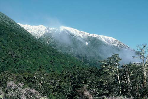
This beech forest clothes the ranges behind St Jacobs Hut, on the banks of the Hope River in inland Canterbury. The forest boundary generally runs along this eastern edge of the Southern Alps, in the mountain ecoregion. Shrubland, grassland and farmland extend east into the drier, leeward ecoregion. Before human arrival the boundary between mountain and leeward regions was not marked by a forest edge. During the past 12,000 years New Zealand’s climate has been relatively warm. This favoured the growth of forests, which covered most of the leeward ecoregion. Polynesians arriving around 1250–1300 AD burnt off these forests, especially in the South Island. By the time Europeans arrived, much of it had reverted to tussock grassland.
Te whakamahi i tēnei tūemi
Reference: 10054134
by C. Mahoney
This item has been provided for private study purposes (such as school projects, family and local history research) and any published reproduction (print or electronic) may infringe copyright law. It is the responsibility of the user of any material to obtain clearance from the copyright holder.