Image
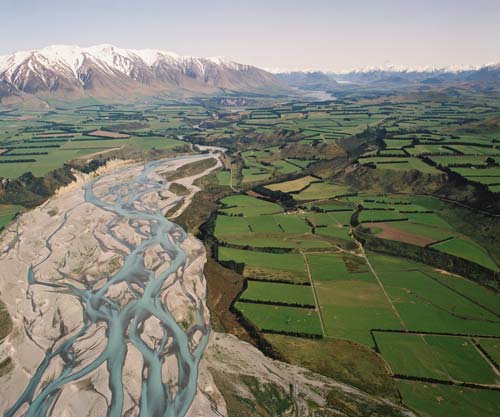
The Rakaia River flows through the Canterbury Plains – part of the leeward ecoregion (east of the Southern Alps). Annual rainfall is around one-third of that on the windward side. The plains were once covered in lowland forest, tussock and swamps, but are now farmed.
Te whakamahi i tēnei tūemi
Reference: CN24034/27
by Lloyd Homer
Permission of GNS Science must be obtained before any use of this image.