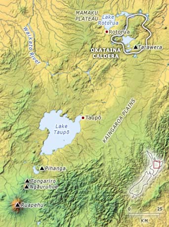
The landscape in the centre of the North Island is dominated by volcanic features, as illustrated in this shaded relief model. The two largest lakes, Taupō and Rotorua, occupy calderas, formed by collapse after huge eruptions. Many of the other lakes near Rotorua have been caused by changes to the drainage after eruptions, and some occupy explosion craters.
Ignimbrite underlies much of the flat areas in the region, including the Kāingaroa Plains and the Mamaku Plateau. These were formed by huge eruptions from calderas, most of which are now buried. In the south a number of large cone volcanoes (Ruapehu, Ngāuruhoe, Tongariro and Pīhanga) are surrounded by gently sloping ring plains formed mainly from lahars.