Image
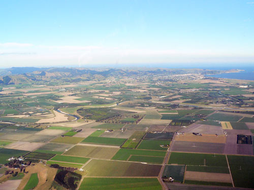
The extent of the Poverty Bay flats, the principal alluvial plain in the region, is shown in this picture, which looks from the vicinity of Ormond south-east towards the city of Gisborne and Tūranganui-a-Kiwa / Poverty Bay itself – both can be seen in the distance. The Waipāoa River, which has created the flood plain, can be seen at middle left. The even and low elevation makes the whole plain vulnerable to flooding.
Te whakamahi i tēnei tūemi
by Ang Wickham
This item has been provided for private study purposes (such as school projects, family and local history research) and any published reproduction (print or electronic) may infringe copyright law. It is the responsibility of the user of any material to obtain clearance from the copyright holder.