Kōrero: Historic earthquakes

Offset road (2 o 2)

Offset road

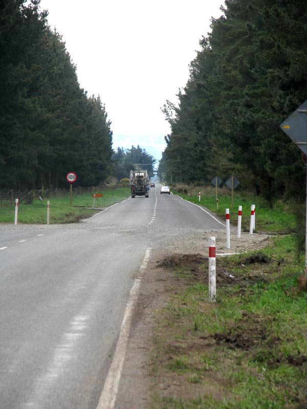
This country road heading northwards across the Canterbury Plains has been offset horizontally by the fault rupture. The surface of the asphalt has been damaged in a narrow band of a few metres. The land in the foreground has moved left (west) and the land in the background has moved right (east). The centre line of the road now almost exactly lines up with the verge line – a displacement of around 4 metres.

Te whakamahi i tēnei tūemi

GNS Science
Photograph by John Begg

Permission of GNS Science must be obtained before any use of this image.

Ngā whakaahua me ngā rauemi katoa o tēnei kōrero

Te tuhi tohutoro mō tēnei whārangi:

Eileen McSaveney, 'Historic earthquakes - The 2010 Canterbury (Darfield) earthquake', Te Ara - the Encyclopedia of New Zealand, http://www.TeAra.govt.nz/mi/photograph/31155/offset-road (accessed 26 April 2024)

He kōrero nā Eileen McSaveney, i tāngia i te 12 Jun 2006, reviewed & revised 28 Mar 2011, updated 1 Nov 2017