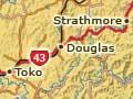
Toko
Rural settlement 10 km east of Stratford on State Highway 43 (the ‘Forgotten World Highway’). Toko is on the edge of the Taranaki ring plain. The township was the most viable of those between Stratford and Taumarunui in the early 2000s.
Douglas brick and tile
Douglas was home to a brick and pipeworks, one of the few in Taranaki. It was established by Alf Emeny in 1920 and featured a Hoffman kiln with an impressive 30-metre chimney. The kiln and chimney were demolished for safety reasons in 1985. A smaller kiln, also part of the brickworks, has been preserved as part of the State Highway 43 heritage trail.
Douglas
Locality 16 km north-east of Stratford on State Highway 43. Along with its store, dairy factory, railway and school, the township had a boarding house which was, for many years, an obligatory overnight stop for stockbuyers or commercial travellers from Stratford.
Strathmore
Locality 30 km north-east of Stratford. Strathmore was named after a Scottish valley, the original home of one of the area’s first Pākehā settlers.
A side road from Strathmore leads to Mākāhu and then to the farm settlement of Aotuhia. The Matemateaonga walkway to the Whanganui River begins at the Kōhī Saddle near Mākāhu.
Te Wera
Locality 37 km north-east of Stratford. Te Wera was the headquarters for extensive experimental plantings of exotic timber trees by the New Zealand Forest Service in the mid-20th century. The Forest Service base is now a recreational camp and arboretum.
Pohokura
Locality 50 km north-east of Stratford. The road over the Pohokura Saddle crosses the second of four ridges which isolate inland Taranaki. Early in the 20th century it was the site of a major tent-camp ‘township’ for railway construction workers and their families.
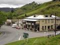
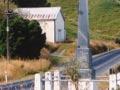
Whangamōmona
Rural settlement 65 km north-east of Stratford on State Highway 43, with a 2013 district population of 150. Sections became available at Whangamōmona in 1897–98. A boarding house and a general store were established, and a post office and other services followed. The present hotel is a 1911 replacement of the original, which burned down in 1905.
The Whangamomona County Council was set up in 1908 and amalgamated with Stratford County in 1955. In the second half of the 20th century all the communities in the valley gradually declined. The school was closed in 1979 and the post office in 1988.
Locals half-jokingly declared Whangamōmona a republic when the local government reforms of 1989 made the town part of Manawatū–Wanganui rather than Taranaki. The biennial republic day draws thousands of visitors from all over the North Island. The hotel is now a popular weekend stopover.
Marco
Locality 5 km north of Whangamōmona. Named after a surveyor’s dog which was killed by a boar, in 2020 Marco had the area’s only remaining school, with a roll of 14. Along the unsealed Marco Road there are remnants of the brick-like mudstone that was used to surface roads before metal from outside the area became available.
Kōhuratahi
Locality 8 km north-east of Whangamōmona. Once a thriving railway settlement, Kōhuratahi now has only its public hall and a roadside war memorial. The monument records that 41 out of 131 local servicemen perished in the First World War, mostly on the Western Front in 1917–18.
Tahora
Locality 19 km north-east of Whangamōmona on State Highway 43. The highway winds along the Tahora Saddle before descending to Tahora, the last settlement before the Tāngarākau Gorge and the Ōhura valley. A few kilometres past the junction, a new road, completed in 1984, allows travellers to reach New Plymouth via Ahitītī. The 85-metre Mount Damper Falls are accessible from this road.
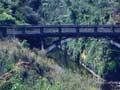
Tāngarākau
Locality 23 km north-east of Whangamōmona, off State Highway 43. In the early 20th century Tāngarākau was a base for building the railway from Stratford to the main trunk line, including driving six of the 24 tunnels. In 1925 the town had a population of 1,200. It boasted a bakery, several stores, a drapery, hairdresser and tobacconist, fruiterer, library, doctor, boarding house, sports fields, maternity home and school. It had three separate areas, for single men, married couples with children, and married couples without children – the ‘seedless raisin’ section. In the 2010s few houses remained.
Tāngarākau Gorge
The Tāngarākau River flows through a spectacular gorge from the farmland of the Ōhura valley. About halfway through is the grave of pioneer surveyor Joshua Morgan, who died there in 1893, aged 35 – probably of peritonitis. Several coal mines operated in the gorge in the 1920s and 1930s.