Image
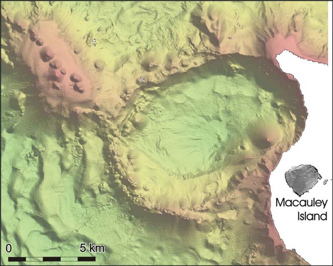
Macauley Island, which is one of the Kermadec group, is a tiny part of a much larger land form under the sea. This model shows that Macauley Island is on the eastern edge of a caldera about 10 kilometres across.
Using this item
NIWA – National Institute of Water and Atmospheric Research
This item has been provided for private study purposes (such as school projects, family and local history research) and any published reproduction (print or electronic) may infringe copyright law. It is the responsibility of the user of any material to obtain clearance from the copyright holder.