Image
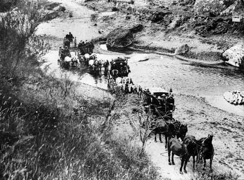
The Devil’s Elbow is a particularly winding and hilly section of State Highway 2 between Whirinaki and Tūtira. This 1905 photograph shows a group of travellers crossing a stream at the bottom of the elbow. This section of road has been straightened in some places but still requires a slow approach and liberal use of brakes.
Te whakamahi i tēnei tūemi
Alexander Turnbull Library, Post & Telegraph Collection
Reference: 1/4-019634; F
Permission of the Alexander Turnbull Library, National Library of New Zealand, Te Puna Mātauranga o Aotearoa, must be obtained before any re-use of this image.