


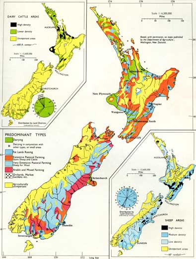
In the 1965 New Zealand world atlas, the plates convey a variety of different information, including topography, population, climate and industries. Here the major map shows the different types of farming in New Zealand, while the map at top left shows the major dairy cattle regions and that at bottom right shows sheep-farming areas.
Te whakamahi i tēnei tūemi
Te Ara - The Encyclopedia of New Zealand
Reference:
New Zealand World Atlas. Christchurch: Whitcombe & Tombs, 1965, Plate 27
This item has been provided for private study purposes (such as school projects, family and local history research) and any published reproduction (print or electronic) may infringe copyright law. It is the responsibility of the user of any material to obtain clearance from the copyright holder.

Tāpiritia te tākupu hou