Image
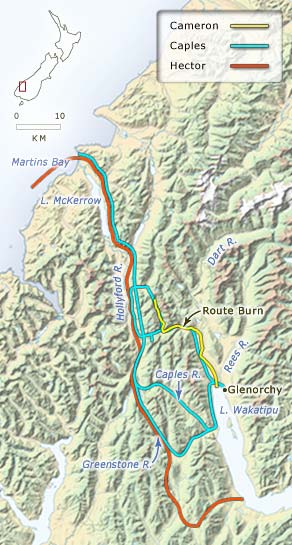
In 1862 there was a rush to find new goldfields in the valleys west of Lake Wakatipu. This map shows the routes taken by Charles Cameron in October 1862, Patrick Caples in the first three months of 1863, and James Hector in the winter of that year.
Te whakamahi i tēnei tūemi
Te Ara - The Encyclopedia of New Zealand
Source: John Pascoe, Exploration New Zealand. Wellington: A. H. & A. W. Reed, 1971, p. 126
This item has been provided for private study purposes (such as school projects, family and local history research) and any published reproduction (print or electronic) may infringe copyright law. It is the responsibility of the user of any material to obtain clearance from the copyright holder.