Explorers
When early Europeans set out to explore the land, they were mostly guided by Māori, along traditional pathways.
Settlers
Europeans also used the old coastal routes, especially on the west coast of the lower North Island and the east coast of the South Island. Townspeople often had to walk to do business. For example, the Bridle Path over the Port Hills linked the port of Lyttelton to the new town of Christchurch.
Settlers soon found other means to get around. By 1867 there was a rail tunnel between Christchurch and Lyttelton. Rough roads were built within and between towns, and people travelled by horse and carriage.
Swaggers
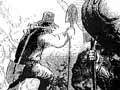
Among the few who continued to walk the roads were the swaggers or swagmen, named for the swags (knapsacks) they carried. They would trudge along the roads on the east coast of both islands, going from one sheep station to the next in search of work.
Miners
In 1861 the discovery of gold at Gabriels Gully, in Central Otago, led to a rush over the Maungatua and Waipori ranges to the Tuapeka River. The discovery of gold at Dunstan, up the Clutha River, brought more miners the following year. A few used packhorses to cart their gear, and some even used their dogs, but most plodded along, carrying a swag.
From Tuapeka the miners walked up the east bank of the Clutha River. From Dunedin they either went north via Palmerston and the Pigroot, or south to Outram and then across the desolate Lammermoor Range.
Flagging the way
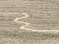
By 1863 the busy route from the Tuapeka goldfields to the Dunstan was marked with planted saplings, each bearing a small black flag. Where there were no trees, rock cairns were built.
In 1865 West Coast gold brought miners flocking over Harper Pass from Canterbury – a track already cleared by the Canterbury provincial government. As early as 1859 a miner from the Aorere goldfields in Nelson had used the Heaphy Track route to the West Coast. Explorer James Mackay marked this out when gold was found at Karamea.
In the Coromandel in the late 1860s, tracks were cut to allow miners to walk to battery sites, where gold-bearing rocks were broken up.
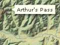
Many tracks soon became roads, or were replaced by new roads, such as the one over Arthur’s Pass. The discovery of copper In the Ruahine Range in 1887 led to new tracks. On the West Coast, coal miners forged paths that sometimes became tramlines.
Farmers and loggers
Farmers formed pathways around their back-country stations, and shepherds made droving tracks to move stock onto high country in the summer, or to muster sheep for shearing. Rabbiters followed their prey to the mountaintops, and in the Ruahine Range, hunters shooting wild dogs built huts and made tracks.
More significant were loggers. Often living in tent townships, they walked through the bush to work, and built bullock tracks or tramways to carry out the timber. In the Waitākere Range their routes to kauri dams later became recreational trails. The Forest Service (set up to log native forests) also cut tracks.
Deer cullers
Deer cullers made many new tracks. In 1930 George Yerex, a former captain in Britain’s Imperial Camel Corps, was appointed by the Department of Internal Affairs to direct deer-culling operations. At first the cullers worked from tent camps, blazing tracks through the back country. ‘The Skipper’, as Yerex was known, saw the need for a more systematic network of huts and tracks. Because he wanted cullers to eradicate deer, all parts of the ranges needed to be within about three hours’ walk from a hut. Anderson Memorial Hut in the Tararua Range was the first to be built, but lack of funds delayed completion of the network.
In 1945 Internal Affairs took on possum hunting, and set up a Wildlife Service. Trappers, paid a bounty for each pelt, used the old tracks and forged new ones. In 1956 the Forest Service took over the job of destroying noxious animals. A hut and track programme began, and the first part of Yerex’s goal was finally achieved.
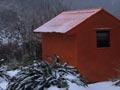
New huts were airlifted by planes and later by helicopters. By the mid-1970s there were over 600 huts, many painted orange, and a network of tracks, carefully marked with blazes or cairns. Today’s recreational trampers enjoy the benefits.