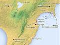

Ngāti Kahungunu is the third largest tribal group in New Zealand. Although it is generally referred to as an iwi (tribe), like a number of other iwi it is perhaps more correct to consider Ngāti Kahungunu a grouping of tribes and hapū (sub tribes), all of whom are descendants of Kahungunu.
The three main tribal divisions are:
- Ngāti Kahungunu ki Wairoa (traditional northern boundary the Wharerata Ranges south of Poverty Bay)
- Ngāti Kahungunu ki Heretaunga (traditional eastern boundary Hawke Bay)
- Ngāti Kahungunu ki Wairarapa (traditional southern boundary the Remutaka Ranges in southern Wairarapa).
The numerous rivers, lakes and harbours within the Ngāti Kahungunu region were important highways as well as sources of food.
Like a river
Te Wairoa hōpūpū, hōnengenenge, matangirau
Wairoa, full of lumps, unevenness and spite
This saying refers to the turbulence and hidden currents of the Wairoa River, and, in a backhanded compliment, suggests that the people are the same.
Te Whanganui a Orotū
The two major pā guarding this area in the Napier region were Ōtātara and Heipipi, but there were many others, as well as extensive settlements on its shores. Te Whanganui a Orotū contained shellfish beds and fishing grounds, and the surrounding rivers, streams and swamps provided eels, freshwater fish, flax and raupō (bullrush). Islands in the Ahuriri Lagoon (raised in the 1931 earthquake) were used as fishing bases, and the fertile land on the shores was favoured for house sites and cultivations.
Lake Hātuma
Around this lake (originally known as Whātuma) near Waipukurau, there is evidence of many seasonal camping sites and villages. Along with Otaia bush (a breeding ground for cormorants) and the Tukituki River, the lake was part of a bountiful and important food-gathering area.
Mountains
Whakapūnake is the mountain where the legendary character Māui snagged his fish hook. It lies at the northernmost boundary of Ngāti Kahungunu, halfway between Gisborne and Wairoa.
Still visible near Whakakī Lagoon east of Wairoa are seven hills: Tahutoria, Takitaki, Kōrito, Onepoto, Iwitea, Tūhara and Hikunui. Tradition holds that they were once seven whales. They are sacred to Ngāi Tahu Matawhāiti, a sub-tribe of Ngāti Kahungunu ki Te Wairoa.
Maungaharuru mountain, between Wairoa and Napier, is where Tūpai, one of the three tohunga of the Tākitimu canoe, placed the mauri of birdlife. ‘Maungaharuru’ means ‘mountain of the sound of a thousand birds in flight’.
Legend has it that Te Mata peak and the hills south to Kahurānaki (near Havelock North) are the body of the ancestor Rongokako, who left his giant footprints at Kahurānaki, Kirihaehae and Whāngārā. His shape is readily discerned when driving through Hastings towards Te Mata peak.
Pā
Te Pakake pā was in the area of Napier now called Ahuriri. When 2,000 men of Waikato, Ngāti Raukawa, Ngāti Tūwharetoa and Ngāti Maniapoto – many armed with guns – attacked the pā, a number of chiefs were killed, including Whakatō, Pakapaka, Hūmenga and Te Hauwaho. The name Te Pakake (the whales) commemorates the battle, likening these fallen warriors to whales.
Puketapu pā was built by Rākaihikuroa, grandson of Kahungunu. About 70 members of Ngāti Māmoe were killed in a battle with Ngāti Ira on this site, which is near Ōmāhu.