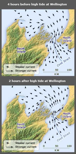
Cook Strait is not only a bottleneck for wind; as this map shows, tidal currents pour through the narrow gap between the North and South islands. They scour the sea floor and transport gravel back and forth. This makes a harsh environment for cables lying along the seabed. The cables are armoured to protect them from abrasion.
Using this item
Te Ara - The Encyclopedia of New Zealand
This item has been provided for private study purposes (such as school projects, family and local history research) and any published reproduction (print or electronic) may infringe copyright law. It is the responsibility of the user of any material to obtain clearance from the copyright holder.
Source: NIWA – National Institute of Water and Atmospheric Research


Add new comment