-
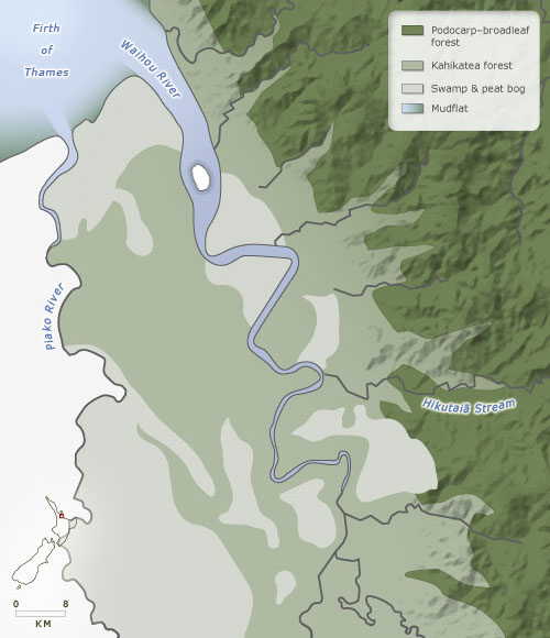
Pre–European vegetation
-
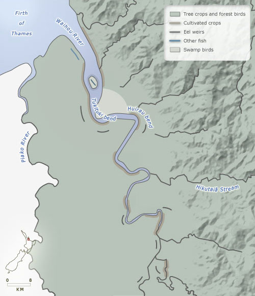
Māori food sources
The banks of the lower Waihou River were covered with kahikatea forest well into the 19th century. On the west bank the Tūrua forest extended, apart from some swampy areas, to the Piako River; on the east bank stands of kahikatea went up tributary river valleys into the Coromandel Range. The range itself supported a mixed podocarp and broadleaf forest, including stands of kauri, the largest tree in New Zealand (kahikatea are the tallest). The kahikatea forest was logged between the 1860s and 1910s, and in 2010 was almost all pasture. Much of the forest in the range, including almost all the kauri, was logged between 1880 and 1920. Some forest has regenerated, and other areas are scrubland – relatively little is farmed.
Using this item
Te Ara - The Encyclopedia of New Zealand
This item has been provided for private study purposes (such as school projects, family and local history research) and any published reproduction (print or electronic) may infringe copyright law. It is the responsibility of the user of any material to obtain clearance from the copyright holder.