


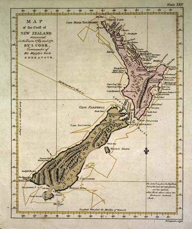
Northland’s distinctive narrow peninsula, bounded by the Tasman Sea on the west and the Pacific Ocean on the east, is depicted with impressive accuracy on this map published in 1773. It was based on charts made by Lieutenant James Cook in 1769–70.
Using this item
Alexander Turnbull Library
Reference:
PUBL-0037-25
Permission of the Alexander Turnbull Library, National Library of New Zealand, Te Puna Mātauranga o Aotearoa, must be obtained before any re-use of this image.

Add new comment