
He kōrero whakarapopoto
What causes earthquakes?
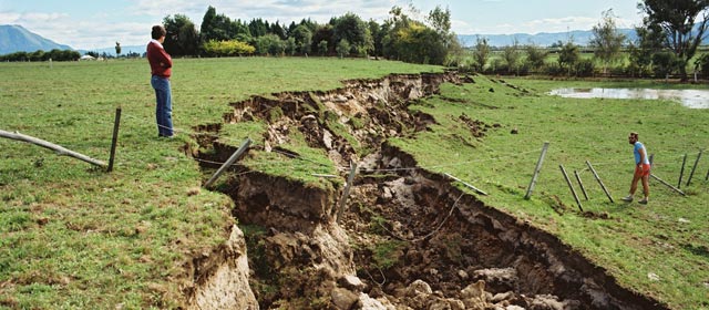
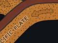
Earth’s outermost layer is made of huge, slow-moving blocks of rock known as plates. Most earthquakes happen where two plates meet. Stress builds up in a plate’s crust (the top layer), and it suddenly breaks, releasing a massive amount of energy. This usually happens along a fault – a split or weak point in the crust. Blocks of rock on each side of the fault move, and on the surface we feel the ground shaking.
Why does New Zealand have earthquakes?
New Zealand lies on the boundary between the Australian Plate and the Pacific Plate. Along these plates, there are many faults, such as the Alpine Fault and the Wellington Fault. Blocks of rock on the faults sometimes move upwards or sideways, producing earthquakes. Every year the country has thousands of earthquakes, and about 200 are big enough to be felt. Since 1840, more than 500 people have died as a result of large earthquakes in New Zealand.
How earthquakes are measured
There are two ways an earthquake is measured:
- The magnitude scale measures the size, or magnitude, of an earthquake. The scale goes from less than 3.5 to more than 9. The biggest recorded in New Zealand was the 1855 Wairarapa quake, measuring about 8.2.
- The Modified Mercalli scale, from MM1 to MM12, measures the amount of shaking at different distances from an earthquake. This is done by looking at the effects on people and buildings. In an MM1 area, only a few people notice the quake, while in an MM12 area it causes total destruction.
Can we predict earthquakes?
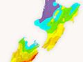
Scientists cannot yet predict where and when earthquakes will strike. But they know that earthquakes happen repeatedly on some faults. In New Zealand, they have identified areas likely to have a damaging quake again. Earthquake-resistant buildings and planning for civil defence will help save lives in these areas.
Making towns and cities safer
In 1931, a magnitude 7.8 earthquake struck Napier and Hastings, killing 258 people. Many were crushed by falling buildings. Others died in fires that could not be extinguished because the city water pipes had burst. Since then, strict rules about design and construction have been introduced in an attempt to prevent new buildings and bridges collapsing in a major earthquake. However, some newer buildings failed in the Canterbury earthquake of February 2011 and some were damaged in the Kaikōura earthquake of November 2016. Many older buildings have also been strengthened, and city lifelines, including water and gas pipes, have been better designed.