


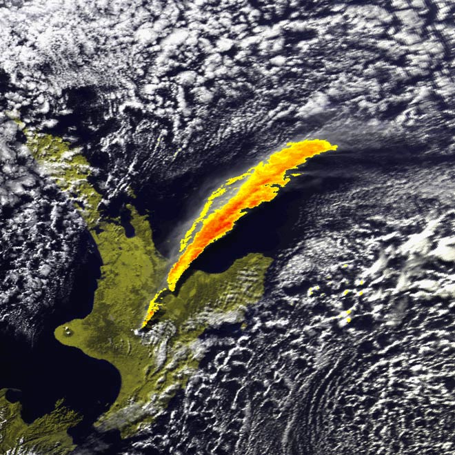
This satellite photograph of New Zealand shows the plume of ash from the Ruapehu eruption of 17 June 1996 extending for hundreds of kilometres north-north-east of the vent. Where it drifts depends on wind direction. The end result, over hundreds of years, is that a dusting of volcanic ash has been added to the topsoil and enhanced its fertility.
Te whakamahi i tēnei tūemi
This item has been provided for private study purposes (such as school projects, family and local history research) and any published reproduction (print or electronic) is an infringement of copyright law. It is the responsibility of the user of any material to obtain clearance from the copyright holder.
Tukunga
this is an awesome website.
marie (not verified)
10 o Oketopa 2011
Tāpiritia te tākupu hou