


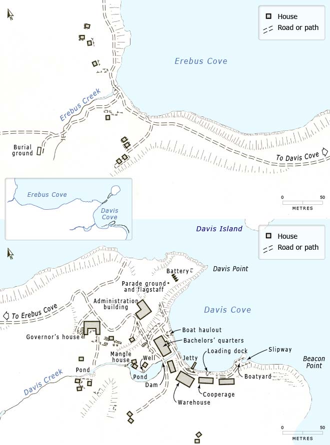
Based on archaeological investigations and historical records, these maps give an idea of the extent of building at Hardwicke, the township for the Enderby settlement at Port Ross on Auckland Island. In addition to some 20 houses for families, there was a substantial house for the governor and a number of community buildings, including a warehouse and a cooperage for building barrels.
Using this item
Te Ara – The Encyclopedia of New Zealand
This item has been provided for private study purposes (such as school projects, family and local history research) and any published reproduction (print or electronic) may infringe copyright law. It is the responsibility of the user of any material to obtain clearance from the copyright holder.
Source: Paul R. Dingwall and Kevin L. Jones, 'The Enderby settlement (1849–52)'. In Paul R. Dingwall, Kevin L. Jones and Rachel Egerton, eds., In care of the Southern Ocean: an archaeological and historical survey of the Auckland Islands. Auckland: New Zealand Archaeological Association, 2009, pp. 59–86, fig. 4.9.
Add new comment